 banner-access-b.webp
Hokuto sits in the north-west corner of Yamanashi, on the border with Nagano. Once here, the sights are spread out, so most people get around by rental car or taxi.
Find your way around Hokuto
Six stations, three expressway interchanges, three areas, and the trails up the mountains around Hokuto. Zoom in with the buttons on the map, then select a station or interchange.
- Railway
- Expressway
- National road
- Hiking trail
- Summit (elevation)
- Trailhead
Explore by area
- Shinjuku, TokyoAbout 2 hoursLimited Express Azusa (Chuo Line)Kobuchisawa Station
- TokyoAbout 2 hoursChuo ExpresswaySutama, Nagasaka or Kobuchisawa IC
- NagoyaAbout 2.5 hoursLimited Express Shinano, change at Shiojiri to the AzusaKobuchisawa Station
- NagoyaAbout 3 hoursChuo ExpresswayKobuchisawa IC
- Kobuchisawa StationAbout 25 minutesKoumi LineKiyosato Station
Select a station or IC for directions. This map shows geographic relationships; check your route before travelling.
Transport gateways
Stations
Kobuchisawa Station
Change between the Chuo and Koumi lines here.
Open in Google MapsKai-Koizumi Station
JR Koumi Line.
Open in Google MapsKai-Oizumi Station
JR Koumi Line.
Open in Google MapsKiyosato Station
JR Koumi Line.
Open in Google MapsNagasaka Station
JR Chuo Line.
Open in Google MapsHinoharu Station
JR Chuo Line.
Open in Google Maps
Expressway interchanges
Kobuchisawa IC
Chuo Expressway interchange.
Open in Google MapsNagasaka IC
Chuo Expressway interchange.
Open in Google MapsSutama IC
Chuo Expressway interchange.
Open in Google Maps
Map data · e-Stat 2020 · MLIT railway 2023 · MLIT expressways 2024 · GSI road centerlines (processed) · GSI vector tiles: footpaths, summits and place names (processed). Trails are shown from map data and do not show current conditions or closures; check before you climb.
By train
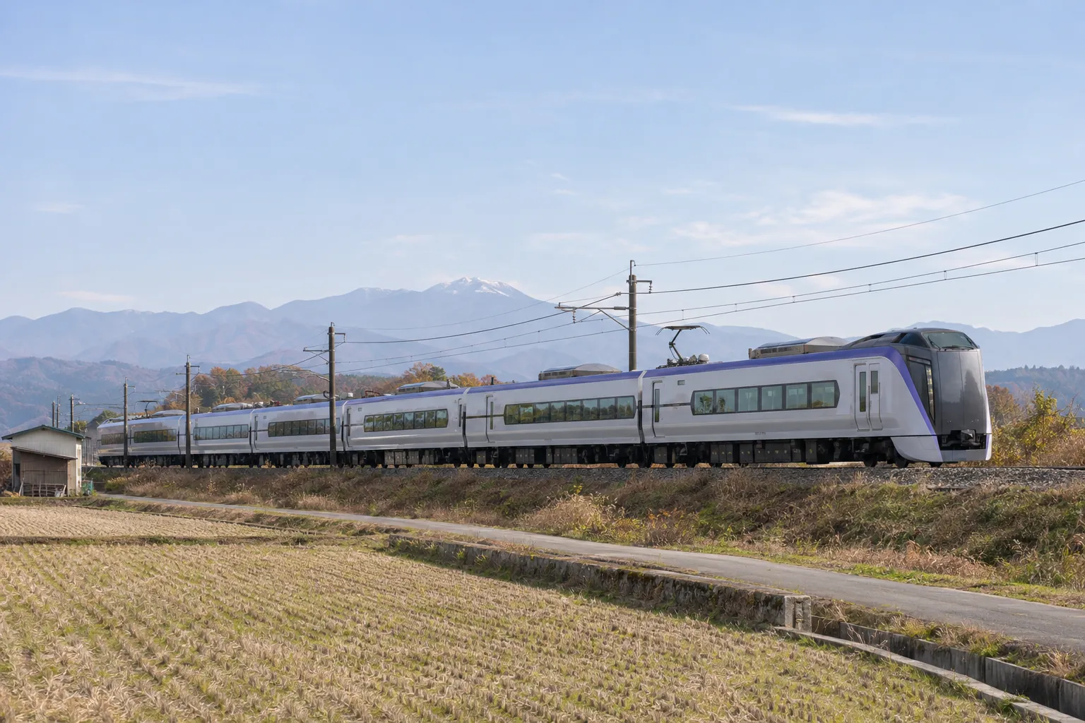
- ShinjukuAbout 2 hoursLimited Express AzusaKobuchisawa
- NagoyaAbout 2.5 hoursLimited Express Shinano to Shiojiri, then change to the AzusaKobuchisawa
- Shin-OsakaAbout 4.5 hoursShinkansen to Nagoya, then the same route as above (including changes)Kobuchisawa
Kobuchisawa Station has no staffed ticket office. Reserved-seat ticket machines run from the first train until 23:15; the video-call operator is available 8:00–20:00
Other stations: Nagasaka and Hinoharu (Chuo Line, local trains); for Kiyosato, change at Kobuchisawa to the Koumi Line
By car
Chuo Expressway: Kobuchisawa, Nagasaka or Sutama IC.
- TokyoAbout 2 hoursChuo ExpresswayKobuchisawa, Nagasaka or Sutama IC
- OsakaAbout 5 hoursKobuchisawa, Nagasaka or Sutama IC
Times are estimates.
From the airport
- Haneda or NaritaAbout 3–4 hoursvia ShinjukuHokuto
Times are estimates.
Getting around Hokuto
Hokuto's sights are spread out and buses are few. To get around, plan on a rental car or a taxi.
Rental car
Days when you want to roam freely
- Where
- Inside Kobuchisawa Station (JR Eki Rent-A-Car). For longer hours, Nirasaki Station
- Price guide
- Compact, 24 h from 8,470 JPY (Eki Rent-A-Car)
English and notes
- English
- English booking site
- Notes
- The driver can't drink. Winter tyres Dec–Mar.
Taxi
Just one or two places from the station
- Where
- Offices in front of Kobuchisawa and Nagasaka stations
- Price guide
- 600 JPY for the first 1.1 km, then 100 JPY per 231 m (upper limit, from 22 Jun 2026)
English and notes
- Notes
- Ride-hailing apps don't cover Hokuto. Book by phone.
Chartered taxi
Brewery and winery days
- Where
- Call a taxi company (your accommodation or our concierge can arrange it)
- Price guide
- About 9,000 JPY per hour (4,490 JPY per 30 min; upper limit for a standard car)
English and notes
- Notes
- The driver waits for you, so tastings are no worry.
Train
Getting to and from Hokuto
- Where
- Chuo Line (Kobuchisawa, Nagasaka, Hinoharu), Koumi Line (Kiyosato)
English and notes
- English
- Station signs in English
- Notes
- Stations are far from most sights, so trains don't work for getting around.
Kiyosato Picnic Bus
Kiyosato days (seasonal)
- Where
- Loop bus from Kiyosato Station
- Price guide
- Single ride 600 JPY (children 300 JPY); day pass 1,200 JPY (600 JPY); 2-day pass 2,000 JPY (1,000 JPY)
English and notes
- English
- Website in Japanese only
- Notes
- In 2026, 25 Apr–16 Nov. Daily in Jul–Aug and late Oct–early Nov; check the calendar on other days.
MOUNTAIN TAXI (shared hikers' taxi)
To trailheads in the Southern Alps and Yatsugatake
- Where
- Leaves Kobuchisawa Station at 9:00; the return leaves at 16:00
- Price guide
- One way 1,500 JPY weekdays, 1,800 JPY weekends and holidays
English and notes
- English
- Website mostly in Japanese
- Notes
- In 2026, June to 15 Nov. Book by 17:00 the day before.
E-bike rental
A short ride around Kiyosato Station
- Where
- Yatsugatake Rent-a-Cycle, by Kiyosato Station
English and notes
- Notes
- Apr–Oct, 9:00–17:00. Closed Nov–Mar. Hilly, so not for long trips.
If you can't book in English, ask your accommodation or our concierge service. Ask us
Rental cars
The only major rental office at a Hokuto station is Eki Rent-A-Car at Kobuchisawa. Cars are few, so book ahead.
JR Eki Rent-A-Car, Kobuchisawa Station
0551-36-4453- Where
- Inside Kobuchisawa Station (exit the 2F gate, then 1F on the right)
- Hours
- 9:00–17:00, all year
- Booking
- Online, from 3 months ahead. English booking site
Prices, winter tyres, one-way and child seats
- Price guide
- S class, 24 h: 8,470 JPY (standard), 9,240 JPY (peak)
- One-way
- Yes
- Child seats
- 550 JPY per 24 h (max 1,650 JPY per seat)
Nico Nico Rent a Car, Kiyosato
- Where
- Near Kiyosato Station (Takane-cho Kiyosato 3545)
- Hours
- 8:00–20:00
- Booking
- Online. Paperwork in Japanese only; contracts through an interpreter or translation app are not accepted. Some offices don't rent to International Driving Permit holders
Prices, winter tyres, one-way and child seats
- Price guide
- S class: 3,740 JPY / 12 h, 5,610 JPY / 24 h (standard nationwide rates)
- Winter tyres
- 2,200 JPY up to 72 h, then 1,100 JPY per 24 h (not at every office)
- One-way
- No (as a rule)
- Child seats
- 550 JPY per 24 h (book ahead; limited number)
Toyota Rent a Car, Nirasaki Station
0551-23-0100- Where
- 1 min walk from Nirasaki Station (outside Hokuto, toward Kofu)
- Hours
- 8:00–20:00 (9:00–18:00 from 31 Dec to 3 Jan)
- Booking
- Online. English website and phone line
Prices, winter tyres, one-way and child seats
- Winter tyres
- 2,200 JPY per 24 h (extra)
- One-way
- Yes
- Child seats
- Baby/child 1,650 JPY, junior 1,100 JPY (per rental)
JR Eki Rent-A-Car, Nirasaki Station
0551-45-9803- Where
- 1 min walk from Nirasaki Station
- Hours
- 8:00–20:00 (8:00–18:00 from 31 Dec to 3 Jan)
- Booking
- Online
Prices, winter tyres, one-way and child seats
- Price guide
- Same as Kobuchisawa
- One-way
- No
- Child seats
- Same as Kobuchisawa
Drivers can't drink. Bring someone who won't drive, or use a taxi.
Taxis
Ride-hailing apps (GO, DiDi, Uber) don't cover Hokuto, so call by phone. Few cars run early in the morning and late at night, so book ahead.
Kobuchisawa Taxi
0551-36-2525- Station rank
- In front of Kobuchisawa Station
- Hours
- 5:30–1:00
Hokuto Taxi
0551-32-2055- Station rank
- In front of Nagasaka Station
- Hours
- 5:30–1:00
Oizumi Taxi
0551-38-2311- Hours
- 7:00–24:00, every day. 20% extra from 22:00 to 5:00
Sutama Sankyo Taxi
0551-42-2328Takane Taxi
0551-48-2211Yatsugatake Kanko Taxi
0551-48-2025Kiyosato Kanko Taxi
0551-48-2021
- Fares
- 600 JPY for the first 1.1 km, then 100 JPY per 231 m (from 22 June 2026; upper limit for the Kyohoku area, Hokuto and Nirasaki)
- Charter rates
- Standard car: 4,490 JPY per 30 min (upper limit), about 9,000 JPY per hour. Check each company's rate by phone
Licences that let you drive in Japan
International Driving Permit
The 1949 Geneva Convention format, carried with your passport. You can't get one in Japan, so get it before you leave.
Your licence + an official Japanese translation
Only for licences from Switzerland, Germany, France, Belgium, Monaco and Taiwan. The translation must be an official one, such as from JAF.
Either way, you can drive for up to 1 year from the day you enter Japan (or until your licence expires, if sooner). Licences from other countries and regions are not enough on their own.
Winter (December–March)
Without winter tyres or chains you can't use the expressways (4WD included). In heavy snow, chains may be required even with winter tyres between Sutama and Nagasaka IC on the Chuo Expressway. Winter tyres cost extra at some offices.
Seasonal notes
Expect icy and snowy roads in winter. Watch for mountain weather and wildlife.
- The Ojiragawa Gorge trail is usually closed from mid-December to mid-April.
- The Kiyosato Picnic Bus runs until 16 Nov and MOUNTAIN TAXI until 15 Nov (2026). The Kiyosato bike rental is closed November–March.
- In heavy snow, chains may be required on the Chuo Expressway between Sutama and Nagasaka IC.
Large luggage
- On the Azusa, you can leave large bags in the luggage space in each car.
Emergencies and medical help
- Police110
- Ambulance / fire119
- Tourist information (Hokuto City Tourism Association)0551-30-7866Mon–Fri 8:30–17:15; closed weekends, holidays and New Year
- Kiyosato Station tourist information0551-48-2200
- JNTO Japan Visitor Hotline050-3816-278724 hours, multilingual
Sources: Eki Rent-A-Car, Toyota Rent a Car, National Police Agency, JAF, NEXCO Central, Hokuto City Tourism Association, Kiyosato Picnic Bus, MOUNTAIN TAXI, Nico Nico Rent a Car, Kanto District Transport Bureau (taxi fares), JR East (Kobuchisawa Station), Hokuto City Tourism Association (Ojiragawa Gorge) / Checked: 2026-10-24